|
The Garrotxa Volcanic Zone is situated 100 kilometres to the
north of Barcelona, an approximate road journey of two hours. It contains some
of the most interesting volcanic landscape in Europe. There are thirty
Strombolian volcanic cones, a few explosive phreatomagmatic craters, other
alternating Strombolian/explosive volcanoes and over twenty very unusually
constructed basaltic lava flows. In addition, the areas moist Mediterranean
mountain climate has contributed to lush vegetation and a spectacular landscape.
Moves to give the volcanic zone legal status go back as far as
1917 but it was not until 1975 that a serious conservation campaign won
widespread support, culminating in protective legislation in 1982. A sharp rise
in urbanisation and industrial development in the area had begun to affect the
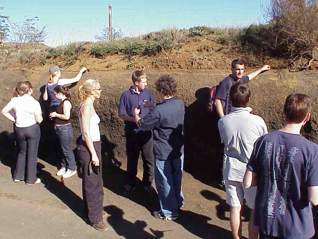
traditional rustic landscape. Volcanic craters were being used as civic refuse
disposal sites and a particularly grave threat to the survival of some of the
most interesting volcanoes was posed by cinder quarries taking material for use
in building block manufacture.
Volcanism is of a basic type, involving basanitic and basaltic
lava. The last dated eruption occurred 11,500 years ago, thus though volcanic
activity has ceased, it cannot be considered to be finally extinct. The volcanic
eruptions varied greatly in intensity owing to the characteristics of the
substratum crossed by the vent and especially because the magma encountered
layers of water-saturated materials.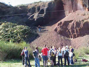
The thirty or so volcanic cones are in a very good state of
natural conservation, considering their age. Most of the craters are visible and
consist of cinder material: scoriae and lapilli with intervening layers of
volcanic bombs. Pyroclastic hecciae are also visible, as well as cineritics and
base surge deposits.
At the Fontfreda cliffs, river erosion has revealed magnificent
prism-shaped columns while at Castellfollit, spectacular layers of lava from
different lava flows are superimposed creating a spectacular cliff with the
village sited at the top. At the 17,000 year-old El Croscat volcano, the lava
mass has a rough surface covered with lava blocks and numerous blisters
(projecting gas bubbles).
Study Options
G.C.S.E.
The objective is to apply a scientific method similar to that
utilised by vulcanologists to study the causes of the volcanic eruptions, the
anatomy of the volcano and the nature of the volcanic rocks.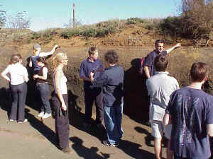
 Form
hypotheses about the stages in the formation of a volcano. Form
hypotheses about the stages in the formation of a volcano.
Form hypotheses about the type of volcanic eruption that occurred.
Relate the
eruption and seismic activity in the area to geological map data.
A Level
The objective is to analyse the environmental impact of some of
the human activities, the actions taken to restore the damaged environments, and
produce a management plan for the Park.
Introduction
to the geological characteristics of the Park and the aims and values of the
Natural Park.
Assess the
value of the Parks natural resources, and the environmental impact of both
cinder extraction and refuse disposal sites.
Study the restoration techniques used in the degraded sites.
Draw up a
management plan which resolves the environmental issues and problems of the
Park.
Additional Options
- The social, economic and environmental effects of rural depopulation.
- The causes and effects of land use changes in hill farming.
- A case study of two contrasting villages, one declining, one growing and the
implications for sustainable rural development.
- Soil Zonation: Brown Earths, Gleys and Podsols.
- Volcanic soils: rankers and volcanic sub-types.
- Hydrosere study (Banyoles).
|